 Asset Publisher
Sale conditions
Sale conditions of wood are specified by the regulation of Director – General of the Sate Forests.

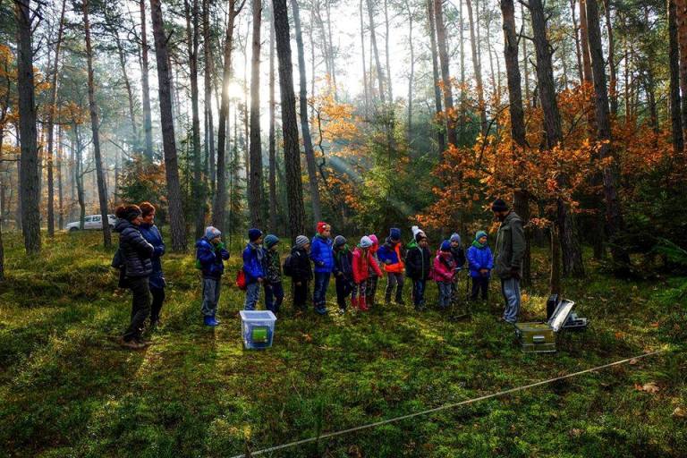
Within the framework of the individual sale , the foresters try to meet the fast growing demand, because more and more people use wood in order to heat their houses. Contrary to general opinion, these are not only village people, even though they prevail among recipients. The growth of firewood demand is the result of occurrence of new housing estates built in the suburbs of large agglomerations, where houses are usually equipped in fireplace heating installations.
Firewood is not only the most ecological heat source, but also is much more attractive in respect of relation of price and electric efficiency, rather than cola, oil, gas or electric power.
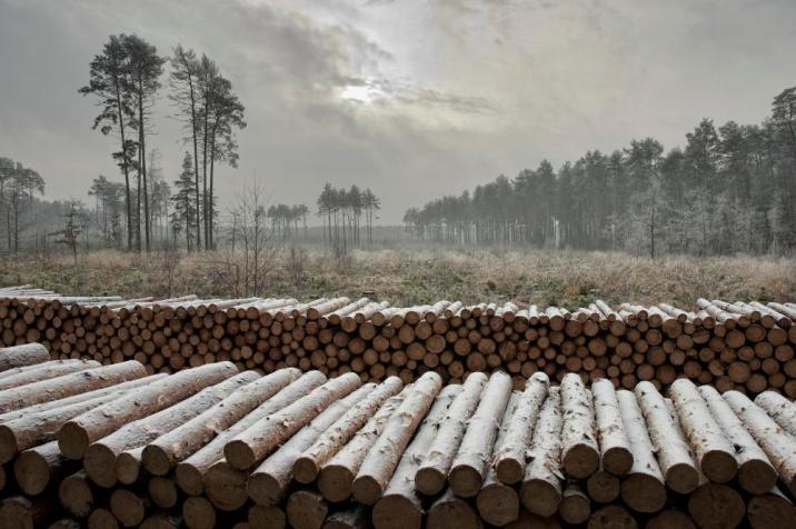
In recent years, the Sate Forests increased the sale of firewood of one third – up to over 4 million cubic meters annually. Firewood is not only the most ecological heat source, but also is much more attractive in respect of relation of price and electric efficiency, rather than cola, oil, gas or electric power. Some of customers choose already prepared and cut into pieces wood, the others very willingly obtain it by themselves after arranging all details and fulfilling particular safety conditions, and after paying the fee; that concerns mainly so called "thinnings". Such a raw material is very cheap, that is why many people from village areas profit from such possibility.
Asset Publisher


Asset Publisher
Lasy Nadleśnictwa
Lasy Nadleśnictwa
 tablica sciezka.jpg
 zaba.jpg
 oczko wodne.jpg
 stos.jpg
Nadleśnictwo Kraśnik jest jednym z 25 nadleśnictw Regionalnej Dyrekcji Lasów Państwowych w Lublinie.
Leży w zachodniej części województwa lubelskiego i graniczy z 5 nadleśnictwami RDLP w Lublinie (Puławy, Świdnik, Krasnystaw, Janów Lubelski, i Gościeradów) oraz od zachodu- poprzez Wisłę- z RDLP w Radomiu. Powierzchnia jego wynosi ponad 13 000 ha i rozpościera się na terenie trzech powiatów (opolskiego ,kraśnickiego i janowskiego), 15 gmin oraz 4 miast (Kraśnik, Opole Lubelskie, Poniatowa, Urzędów). Cechą charakterystyczna nadleśnictwa jest znaczne rozdrobnienie oraz rozrzucenie kompleksów leśnych na dużym obszarze (66 kompleksów).
Urozmaicony krajobraz terenu nadleśnictwa tworzą wzgórza z licznymi jarami i wąwozami lessowymi, a także doliny rzeczne Chodelki, Wyżnicy czy Potoku Wrzelowieckiego. Od zachodu opiera sie ono o Małopolski Przełom Wisły. Wg rejonizacji przyrodniczo-leśnej cały obszar nadleśnictwa leży w VI Krainie Małoposkiej, 4 Dzielnicy Wyżyny Zachodniolubelskiej, w mezoregionach fizjograficznych: Wzniesienie Urzędowskie, Równina Bełżycka i Kotlina Chodelska.